




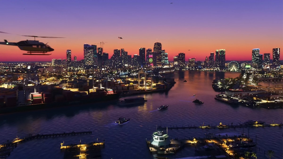
Rockstar is taking us back to Vice City, but the scale is absurd this time. The State of Leonida isn’t just a shiny HD remake of 2002’s neon playground, though. It’s shaping up to be a massive, multi-county landmass built to dwarf Los Santos.
If you’ve analyzed the latest leaks alongside community discussions, you already know the scale will be historic for the franchise. We combed through every frame of footage, mapped coordinate leaks, and cross-referenced real-world Florida geography to build this guide of GTA 6 map locations.
Make sure to also check out our GTA 6 Netflix extended look gameplay details before diving into the geographic breakdown below.
Quick Reference: State of Leonida Region Matrix
Before the full geographical breakdown, here’s a quick snapshot of Leonida’s confirmed and leaked territories. It links each region to its real-world Florida equivalent, along with its current verification status.
| Region / County | Major Hubs & Landmarks | Real-World Inspiration | Verification Status |
| Vice-Dale County | Ocean Beach, Little Haiti, Stockyard, VCIA Airport | Miami-Dade County | Confirmed |
| Leonida Keys | Key Lento, Gloriana Key | Florida Keys | Confirmed |
| Grassrivers / Ambrosia | Port Gellhorn, Dirt Bike Tracks, Swamps | Everglades & Central Florida | Confirmed |
| Mount Kalaga | National Park, Forest Trails, Elevation Peaks | North Florida / Georgia Border | Confirmed |
| Leonard County | Suburbs, Industrial Strip | Broward County | Confirmed / Leaked |
| Kelly / Lummox County | Rural Towns, Panhandle Borders | Rural Florida / Alabama Border | Leaked |
How Big is the GTA 6 Map? Scale vs. GTA V & RDR2
The estimated GTA 6 map size lands at roughly double the landmass of Los Santos and Blaine County combined. GTA 6 map leaks referencing engine telemetry show coordinates stretching far past standard bounds.
That means a map at least 2.5 times larger than Grand Theft Auto V.
Rockstar seems to have engineered unprecedented building interior density, interactive shopfronts, and deep water physics across the board. Ocean Beach alone feels both massive and populated. The sheer landmass difference is staggering.
Map Scale Comparison (Estimated Landmass)
| Game Title & Region | Relative Scale Multiplier | Estimated Footprint & Scope |
| GTA V: Los Santos | 1.0x (Base Baseline) | Urban core + Blaine County countryside |
| RDR2: Wild West | 1.5x | Five massive frontier states & varied biomes |
| GTA 6: Leonida | 2.5x | Vice City metro, Keys, Everglades, and rural counties |
Scale Highlights
- GTA V (Baseline): Serves as the modern standard (~49 sq km / 29 sq miles landmass), featuring one major city surrounded by rural mountains.
- Red Dead Redemption 2: Expands total land area significantly with dense, highly detailed natural terrain and distinct regions across five fictitious states.
- GTA 6 (Leonida): Estimated to more than double GTA V’s playable surface area, introducing multiple urban hubs, vast wetlands, distinct island chains, and extensive interior spaces.
Ready to lock in your copy before launch day? Check out our complete GTA 6 pre-order guide and available editions to secure your bonus content early.
Every Confirmed GTA 6 Location (Official Rockstar Data)
Areas showcased in official trailers and press drops highlight a completely distinct environment, economy, and local subculture. Here is a breakdown of all the confirmed territories you’ll get to explore once the game launches.
1. Vice City (Vice-Dale County)
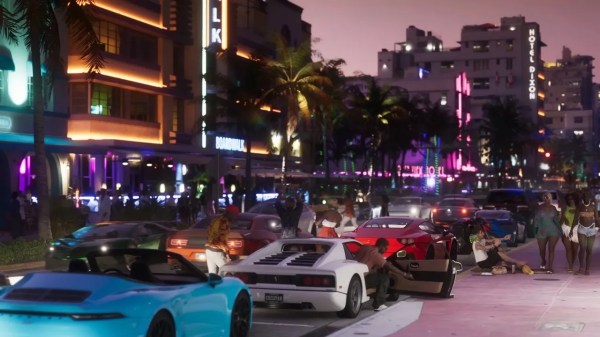
GTA 6 Vice City districts will make up the game’s dense urban heart. Ocean Beach returns with vibrant neon hotels, supercars cruising the strip, and populated boardwalks. Further inland sits Stockyard, a gritty industrial zone inspired by Miami’s Wynwood art district.
Players are also expected to explore Little Haiti, Little Havana, and Vice City International Airport (VCIA). High-end spots like the Effluvia Rooftop Bar and Megamundo HQ serve as crucial hubs for story missions.
2. Leonida Keys (Florida Keys Counterpart)
Stretching off the southern tip of the main island sits the Port Gellhorn, Leonida Keys cluster. Key Lento and Gloriana Key could offer visitors a total change of pace from the city traffic.
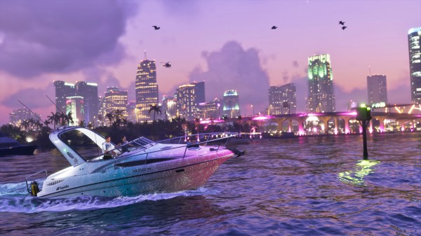
Jet skis, speedboats, and airboats dominate transport here. Expect low-slung holiday homes, tiki bars, and highway choke points that make police chases absolute chaos.
3. Port Gellhorn & Grassrivers (Everglades)
Heading west into the Grassrivers gives players mud, tall grass, and aggressive wildlife. This swampy stretch heavily mirrors the real-world Florida Everglades. Expect hovercraft pursuits, alligator attacks, and hidden drug labs tucked deep in the murky waters.
Meanwhile, Port Gellhorn borders the wetlands as a rusted, industrial strip center. It features dirt bike tracks, rundown motels, and cheap liquor stores.
4. Mount Kalaga National Park & Rural Hinterlands
Florida’s geography is famously flat, but Rockstar tweaked reality a bit for this game. Located in the far north, Mount Kalaga National Park brings dense forests, hiking trails, and sudden elevation shifts to the map.
It breaks up the coastal flats with heavy off-road terrain. Mudding trucks, dirt bikes, and hunting gear will be essential for players navigating these mountain backwoods.
Leaked & Speculative GTA 6 Map Locations
These speculative areas showcase just how far the map stretches north and west into Leonida’s borders. Here is a closer look at the rumored counties, secondary towns, and offshore zones expected to round out the state.
1. Lummox County & Northern Panhandle
Leaked developer coordinates point toward Lummox County, an area bordering northern forest zones. This region mimics the panhandle culture on the Florida-Alabama line. Expect small-town gas stations, isolated trailer parks, and long highway runs ideal for high-speed police escapes.
2. Rumored Sub-Cities & Surrounding Towns
Leaked event scripts highlight several smaller secondary towns scattered across Leonida:
| Area / Location | Environment & Style | Gameplay & Strategic Significance |
| Hamlet & Belville | Quiet residential communities | Suburban hideaways tucked behind Vice City’s main highway belt |
| Watson Bay | Coastal fishing town | Maritime access hub, likely tied to off-grid smuggling operations |
| Capri | Upscale gated island enclave | Exclusive luxury sector reserved for high-value heist targets |
GTA 6 Map Comparison & Features (At a Glance)
Size is only part of the equation. How players interact with space dictates the actual experience. The State of Leonida represents a total overhaul of environmental engine tech, density, and world responsiveness.
From structural interior depth to real-time weather events, here is how Leonida’s core features stack up against past Rockstar titles.
1. Unprecedented Interior Interactivity
- Over 700 Explorable Buildings: Unlike GTA V’s static, walled-off cityscape, Leonida grants direct entry to over 700 unique interiors without a single loading screen.
- Dynamic Robberies: Over 150 small businesses that range from convenience stores and pawn shops to strip-mall bars.
- Tactical Evasion: Running through crowded shopping malls, skyscraper lobbies, or multi-story parking garages breaks sightlines to confuse police AI during high-wanted pursuits.
2. Live Transit Systems & Infrastructure
- Interconnected Mass Transit: Fully functional metro trains, city buses, and regional highway networks run on realistic schedules across Vice-Dale County.
- Aviation & Marine Depots: Multiple functional airstrips and deep-water docks support large cargo transport, private jets, and watercraft.
3. Dynamic Environmental Engine
- Tropical Weather Systems: Hurricanes, sudden tropical downpours, and localized flooding dynamically alter road traction and boat handling.
- Evolving World Architecture: Internal structural frameworks suggest Rockstar built Leonida to expand over time, laying the groundwork for post-launch island additions, new interior openings, and seasonal map updates.
Final Thoughts
The State of Leonida is shaping up to be Rockstar’s most detailed open world to date. Between dense Vice City streets and treacherous swamp networks, players will have massive ground to cover at launch.
Read our breakdown on Jason and Lucia’s story dynamics to see how the leads navigate these districts, or learn how to execute seamless squad tactics with our guide on the seamless character-switching system.
Check out some of our most popular Boosting services:


Frequently Asked Questions
Is the full GTA 6 map officially revealed yet?
No. Rockstar has only confirmed Vice City, the Keys, Grassrivers, and Mount Kalaga through official trailers, while remaining counties stem from mapping leaks.
Can you fast-travel across the map in GTA 6?
Yes. Players can fast-travel using the Vice City Metro transit line, booking rideshare trips on in-game smartphones, or buying commercial airline tickets at VCIA.
How does the 6-star wanted system affect map exploration?
Reaching 6 stars triggers state-wide highway checkpoints, automatic license plate scanning cameras, and military-grade blockades that completely lock down travel between counties.
Will fuel and vehicle maintenance limit long-distance driving?
Vehicles now feature real-time fuel consumption and engine wear meters, requiring players to pull over at gas stations or repair shops during long cross-country road trips.